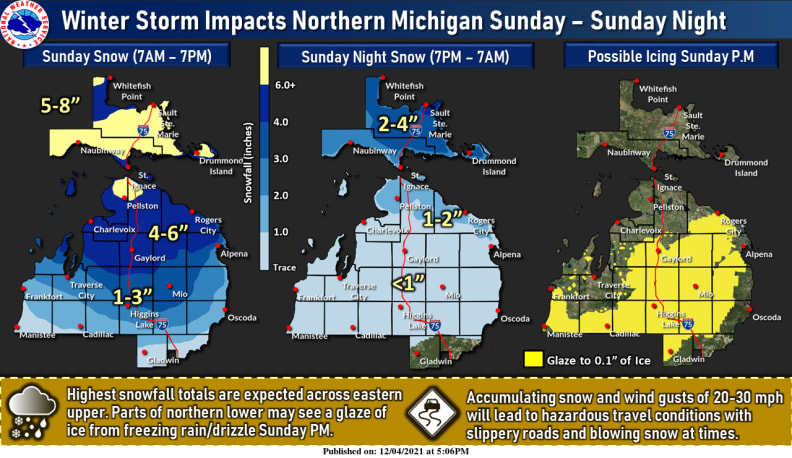
Forecasters are calling for 5-8 inches of snow on Sunday in the UP, with snow and possible icing Sunday afternoon in the northern lower peninsula.
The highest snowfall totals are expected across the eastern upper peninsula and at tip of the Mitt. Parts of northern lower MI are predicted to receive 4-6 inches on Sunday with another inch or two falling overnight. Northern MI may also see a glaze of ice from freezing rain/drizzle Sunday afternoon.
Accumulating snow and wind gusts of 20-30 mph will lead to hazardous travel conditions with slippery roads and blowing snow at times. Members are encouraged to make contingency preparation early Sunday for the potential of power outages.


